Total War: Warhammer Map Creation
I decided to have a go at map making again, it's been a long time since I've had a crack at a new map editor/game engine. And what better engine that Terry! (The Terrain Metadata Editor).
After quickly getting to grips with the editor I started making an overly large map for standard pitched battles. The editor boasts a huge plethora of assets to cater to a designers desires for theme/pacing/visuals and so on.
After playing a good many hours in Total War, the general map layouts are relatively simple at a glance. A few small caveats to take into consideration when creating a map.
- Map Size
- Player Size (1v1 / 2v2 / 4v4 )
- Balance
- Interesting terrain deformation
- ?
Map size is relative to player size, naturally. The more players on a map the larger the battlefield can be, and thus the better utilized the terrain elements can be (Having a 4v4 with 1 choke point would be a mostly boring match, watching 1 unit fight 1 unit until someone runs out of troops). Adding in additional avenues of attack, as common sense would dictate, allows for a more dynamic battle.
Balance is a strange consideration in this regard, a battlefield will never truly be advantageous to both parties - realistically speaking, at least for the most part. What is achievable here is offset each advantage. If player one has a large hill in their deployment zone, this can be offset for player two by adding a small forest area in their deployment - This essentially offsets each "advantage" without completely nullifying the use of that advantage, i.e. the hill isn't completely useless due to not being able to fully see all units that player two has.
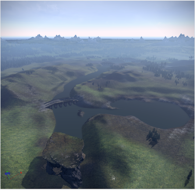
Here's my first attempt at a large-scale map, I'll be making new revisions as I go, and it will require copious amounts of playtesting, but I'm liking the aesthetic so far and feel the balance is coming along.
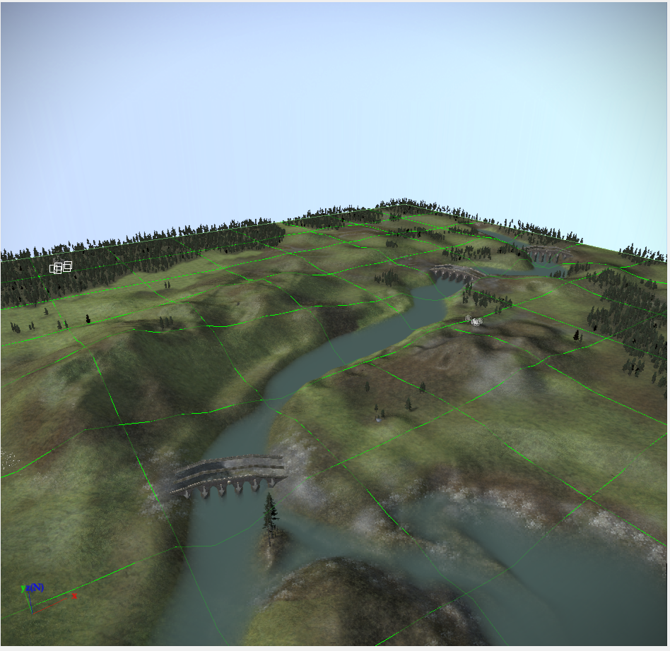
Editor View:

Editor View:

I'd like to talk about my thought process here. So I'll add images with annotations (bad paint ones too!)

Let's assume player 1 is red and player 2 is blue. The rectangles are indicative of deployment zones, the yellow arrows are bridge locations, the circles are large hills and the random lines are avenues of attack.
Essentially the left flank with the red line can be utilized by both players (I only drew one line oops!). Now, at a glance, it seems player 1 (Red) has an advantage over player 2 (blue) due to the distance of the hill from respective deployment zones. However, at a better view (It's further down!) the blue hill has slightly larger and wider than the red hill and hugs the nearby bridge area. This acts as a Line of Sight Blocker for the blue player, allowing them to use it as a pseudo cover. While not fully negating the purpose of the red hill (Artillery/Line of sight/defensive ground) it will alleviate any huge advantage of sorts.

The heat map above better showcases the previous scenario, mainly the density of the hills that player 1 (Red) can utilise for cover - again this is at a small cost, mainly distance travelled/fatigue for troops. We could incorporate some difficult terrain here (shallow water/marshes etc) but that will require some play testing before any further adjustments.
Here are some more shots of the map from various angles. I don't consider this finished, more of a white box/grey box variant - there's a lot more detail to add and a lot of balance to be finalized, but I got the ball rolling.


Comments
Post a Comment